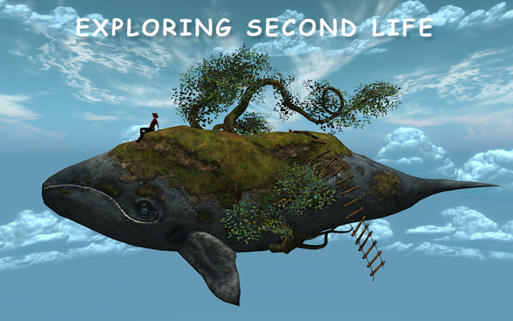
In a world where most people travel by teleport, it is easy to forget what sim or continent you are on in Second Life . This is a brief guide to Satori, the fourth continent.
 |
| Yavapod Map showing Satori as it was in 2016. The light blue lines indicate the routes of the Yavapod tours. |
Satori was the fourth continent created in Second Life, after Sansar, Heterocera, and Jeogeot, and the first of the 'eastern' continents. It was started in February 2007 and the land portion was finished on June 18th of the same year. I have read that it was originally called Maebaleia (In Portuguese "Mae" is 'Mother' and "baleia" is 'whale', so Maebaleia apparently means "Mother Whale") and you will see it listed as both "Satori" and "Maebaleia". If you look at the map, it is easy to imagine a whale with a calf.
Some people thought that "Maebaleia" was too hard to spell, and after a vote on the old SL forums the name was changed to "Satori". One meaning of "Satori" is "enlightenment". It has also been called the "Asian" or the "Japanese" continent, and the frequent signboards echo an eastern style theme.
In March 2007 Second Life resident Dimitrio Lewis flew over the new continent as it was under construction: https://www.youtube.com/watch?v=n9tpUP65d54BasenShishapangaSRowan
To get an historical perspective: In 2007, when this continent was constructed, the media was full of articles about Second Life. It was less than a year since Ansche Chung's picture had been on the cover of Business Week, and there were many residents wanting land. According to the old forums, the Lindens were auctioning off multiple sims at a time, and some went for very high sums.
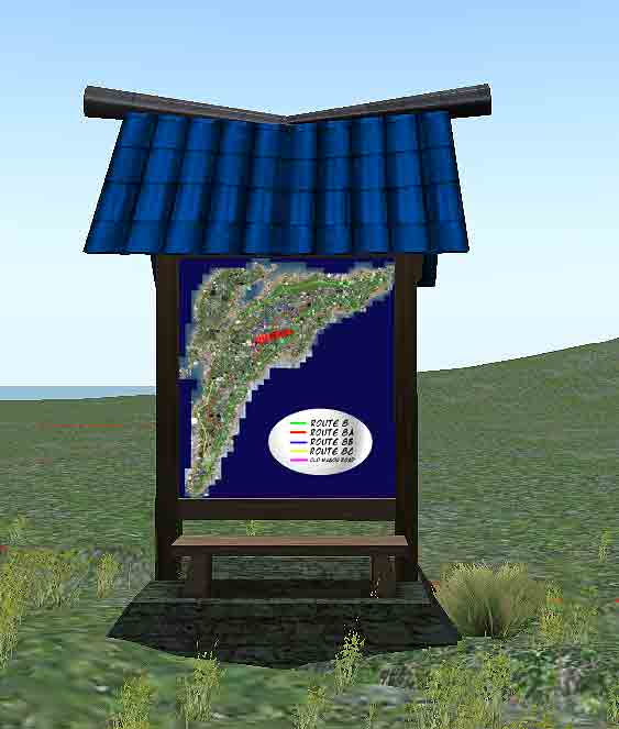 |
| One of the map stations throughout the Satori network. |
It was not until late in the next year that the roads in Satori (Route 8, 8A, 8B, 8C, and the Old Wagon Road) were completed. Because some of the sims that were in the right-of-ways had been sold, many roads have dead ends and are connected by false tunnels with teleports, or billboards with teleports. The map kiosks along the road are a big help.
See the Second Life Wiki for more information on the Satori Network. I have to hand it to the moles that built the roads, considering the difficulties they had to overcome. Without the constant map posters, it would be easy to get lost.
 |
| A teleport billboard at a dead end. You click on it to be teleported to the other end of the road. |
 |
| The Dead End Diner |
Many of the 709 sims in Satori have no road or water access. Because Linden Labs sold a lot of water land all along the shore there are places where you cannot sail because resident's builds block what would have been a nice sailing route. There are still many places with nice sailing, but I believe it is impossible to circumnavigate Satori by sea. Sailing is more popular along the northern shore, because you can sail to Nautilus and some further parts. I found that you could sail from Tuulikki Castaway Beach Rez Zone in South Satori north to Nautilus, with some twists and turns. Flying is popular and there are several busy airports.
There are several mole-built coastal islands that were built later, which I will discuss in a separate article. Meauxte Bureaux is the most famous.
 |
| Where two roads meet. |
There are several mole-built coastal islands that were built later, which I will discuss in a separate article. Meauxte Bureaux is the most famous.
 |
| Map of the Mainland Continents - the left is a close-up of the first Mainland, on the right is a map showing all eight Mainland 'continents'. Privately-owned islands are not shown. |
The next Linden Project was Nautilus, then Corsica, Gaeta V, and Gaeta 1. As each of these new regions opened up they attracted new residents, and by the time Gaeta 1 came online the demand for new land had levelled out.
Satori contains many pleasant areas and some of my favorite places, and while there are some very popular areas there is also a lot of empty space.
If you visit:
Start at the Southern end of Route 8 at Bagheera. There is a large map kiosk there. If you follow Route 8 north and then around the curve to start South again, you will come to a teleport tunnel at Bietschhorn. From there you can use the Second Life Map if you want to travel all the routes. I will be making a separate notecard just for the Satori network.
The easiest way to get around would be to take a Yavapod tour - there are three pod stations in Satori - check the Yavapod notecard for exact coordinates.
..........................................................................................................................................................
I am indebted to the following sources:
Ana Imfinity's SLGI Wikia http://slgi.wikia.com/wiki/SLGI_Wiki and her contributions to the Second Life Wiki http://wiki.secondlife.com/wiki/Satori
I also got information from Virtual
Christine’s “Guide to Second Life Geography”,
http://virtualchristine.com/2011/07/02/the-fourth-virtualchristine-newbie-guide-to-second-life-geography/ (As of 5-3-2021 this blog is no longer there, and I can find no trace of Virtual Christine anywhere.)
Most recently I found the most excellent blog, Second Highways, which gives detailed driving instructions for driving the Satori Routes.
Old forum guides; http://forums-archive.secondlife.com/327/c5/213526/1.html (September 2007)
and from the SL Aviation Wikia http://sl-aviation.wikia.com/wiki/Category:Airports
A notecard with landmarks is available at my Unofficial Tourist Information Office in Maryport, Second Life.
About naming the continent: apparently there was a resident vote http://forums-archive.secondlife.com/327/c5/213526/1.
and the name Satori – the Japanese Continent
was chosen. Satori is the goal of Zen.
and from the SL Aviation Wikia http://sl-aviation.wikia.com/wiki/Category:Airports
One of the best resources is Dahlia Jayaram’s The Great Balloon Adventure: Satori
https://issuu.com/dahliasweet/docs/thegreatballoonadventuresatori
on issu
- I was fortunate to chat with Dahlia Jayaram when I was wrapping up my final exploration of Satori and she was kind enough to give me a lot of information for my Tourist Information Center and a link to another explorer's adventures in Satori:
- I was fortunate to chat with Dahlia Jayaram when I was wrapping up my final exploration of Satori and she was kind enough to give me a lot of information for my Tourist Information Center and a link to another explorer's adventures in Satori:
Also see Virtual World Sailing http://www.virtualworldsailing.com/index.php?/topic/153-exploration-of-satori-continent/ September 2014
You will not be able to recreate any of these travels - things on the Mainland change constantly - but whatever you do, it will be your own adventure.
You will not be able to recreate any of these travels - things on the Mainland change constantly - but whatever you do, it will be your own adventure.
A notecard with landmarks is available at my Unofficial Tourist Information Office in Maryport, Second Life.

No comments:
Post a Comment