The World Map
 |
| World Map, Zoomed Out |
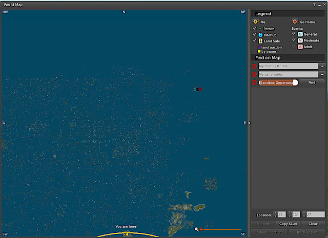
If you are in Second Life, and open Map View, and zoom out, you will see the above image. The yellow circle shows the location of your avatar; the house symbol represents the location you have designated as home. At this resolution you cannot see the other symbols. The larger objects in the center are the continents of the Mainland, Premium Home continents, and private Regions.
This is not ALL of Second Life; however. You can drag the map around to see more.
 |
| Drag the map around to see the edges of Second Life. |
Now, enlarge the map.
 |
| A closer view. |
Blue on the map, in a named region, is water. An unnamed blue region is probably "Void Ocean" which cannot be traversed except by teleporting.
Understanding What You See On the Map:
The mainland is a Second Life area in which Linden Lab is the estate owner and exercises elevated discretion regarding content and design. Special rules and policies apply to landowners and businesses on the mainland. The Mainland Policies are incorporated into Second Life's Terms of Service
Private Regions and Homesteads - Land or water where the estate owner is the one in charge and makes his/her own policies regarding use. They may or may not be open to the public.
You will also find:
Linden public 'protected' land that usually has public access but is not available to buy or rent:
- Landmarks and heritage sites
- Roads
- Some waterways
- Abandoned land being held until it can be re-sold.
- First Generation Housing
- Bellisseria
Some Definitions:
Region - an area 256 by 256 meters.Agni - another word for The Grid. The testing grid is called Aditi*.
Void Ocean - the 'big nothing' between places. You cannot move through it - you will have to teleport over it.
Land - a place with a physical surface.
Water - a physical surface, but covered with water.
Sky - the accessible area over land or water up to about 4000 meters. A lot of people build and live there in what are called "skyboxes".
Continent - usually refers to a mass of 30 or more regions connected to each other in such a way that you can move between the regions without teleporting. Because Sharp has lost Regions some do not consider it a 'real' continent. Sorta like Pluto...


No comments:
Post a Comment